Hiking the Cayolle Pass in the South of France
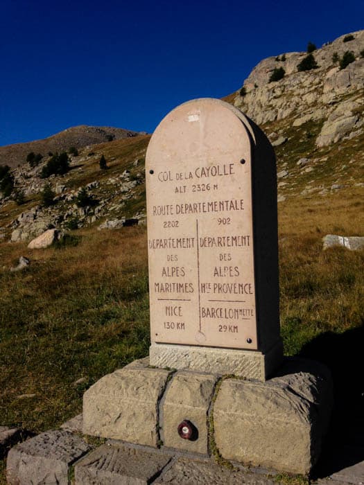
You may remember last week that I told you all about a quest we went on to find the source of the Var River. The day after discovering the tiny puddle that the big river stems from, we decided to go for a glorious hike in an area that can only be reached in the summer: The Cayolle Pass. In the winter the road is covered with deep snow, so unless you are very intrepid and own a snowmobile, or a husky pack, it’s impossible to get to.
As you can see below, the hike started at the already lofty altitude of 2,300 meters (7 500 feet). The trail climbed up to the Pas du Lausson at 2600 meters (8 500 feet). It was good that we had spent one night at the Relais de la Cayolle to acclimatize. Of course, compared to Mt Everest, the Macchu Picchu trail, or even many hikes in the alps in Italy, it’s not that high, but if you are not used to the altitude, your heart will race and make you huff and puff very quickly when you start walking up the trail. Well, that’s the excuse you can make…..

Marmots, parking lots, and wondrous views
The views were already amazing shortly after leaving the parking lot. In fact, a friend we used to hike with in California always said that the best views on the hikes we did were from the parking lot. Often, he was right! In this case, the higher we climbed, the better they got, which is just as well. If you make a big effort for the same view that you can see from you car, it kind of takes the joy out of the whole experience. There were marmots everywhere, waddling around and whistling to each other, which makes any hike worthwhile immediately, in my opinion.
How to feel very virtuous
We were hiking a loop trail, so headed up on the South side of the Tête de Crépine, which is the steep slope you can see in the photo above. Another thing I love about hiking, aside from the marmots, is being able to look behind you and see where you’ve been. That tiny trail cutting across the slope is where we had walked. There’s something immensely satisfying about knowing you’ve arrived where you are standing under your own power.
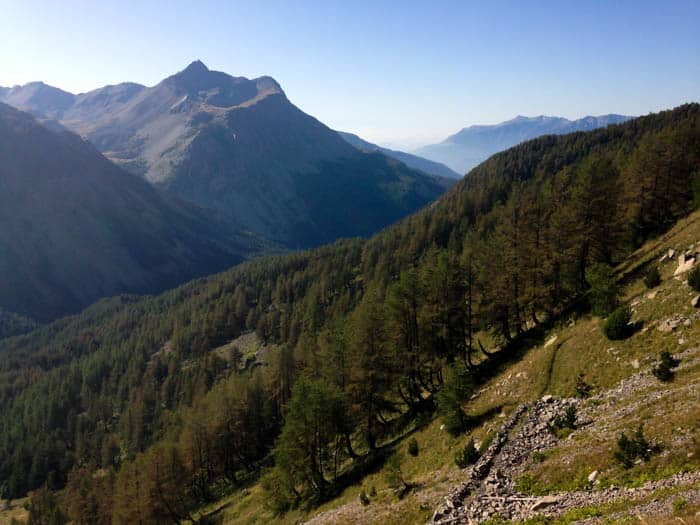
Once we got to the top, the view made it all worthwhile. We could see the valley the Var River starts its journey in, and where we had zigzagged up to reach the Cayolle Pass and mountains as far as you can see.
The view from the top
From the highest point of the hike, we were also able to gaze down at the stunning Allos Lake. You may remember that we went hiking and marmot spotting there a couple of years ago, and came nose-to-nose with a city of marmots. The sign said that the lake was only an hour’s walk away, which made it very tempting, until we looked that how far down it was. It may have only take an hour to skip down to it, but it probably would have taken at least 2 hours to toil our way back up to the pass again. The amazing thing is that if you drive from the Cayolle Pass to the Valley of Allos, it takes you longer than it does to walk over the mountains from one to the other.
After admiring the view for a while (and catching our breath), we headed along the ridge and then down to the green jewel of a lake you see below called Lac du Garet. A few brave hikers actually went swimming in the lake, but I’m a total chicken when it comes to cold water. Dipping one finger in was enough to make me back up so fast that I nearly tripped over my own feet.
The scary part of hiking in the mountains
After our sandwiches, we continued along past the lake to a trail that made me want to screw my eyes shut and start quietly whimpering. I suffer a little from fear of heights, and the trail cut across the side of the mountain on a scree-covered slope, where far, far below the Lac de la Petit Cayolle glittered malevolently in the sun. This is one part of hiking in the mountains that I’m not fond of. When the rest of the family skipped and hopped along this bit of the path, I plodded along it like I was walking on the ledge of a skyscraper, imagining that at any minute I would slide down the steep slope to certain doom in the lake far below. OK, from the photo, it doesn’t look that steep, but I swear it was (at least in my head)! Obviously, I made it as I am typing this now with all my limbs intact.
The trail you see cutting down to the lake in the photo above heads towards the summit of the highest mountain in the area called Mt Pelat. That one will be for another day as it’s a very long hike. Instead, we turned right and headed down another part of the trail I didn’t like the beginning of much (see below) which headed down on the North side of the Tête de Crépine.
The horror of steep hairpins
I was quite pleased to get to the bottom of the hairpins, and hike out along the valley floor past a few more marmots scuttling around and this beautiful lake edged with cotton-ball flowers called Scheuchzer’s Cottongrass. Just for the record, they really are as soft as they look. Do you think I could walk by them without touching them?
This post is part of a linkup to a monthly event called #allAboutFrance run by Phoebe, who runs a lovely self-catering holiday rental on the Cote d’Azur. You can read about other parts of France in the linkup by clicking here.
By Lisa Watson

